Ground MappingRisk DetectionSite Verification
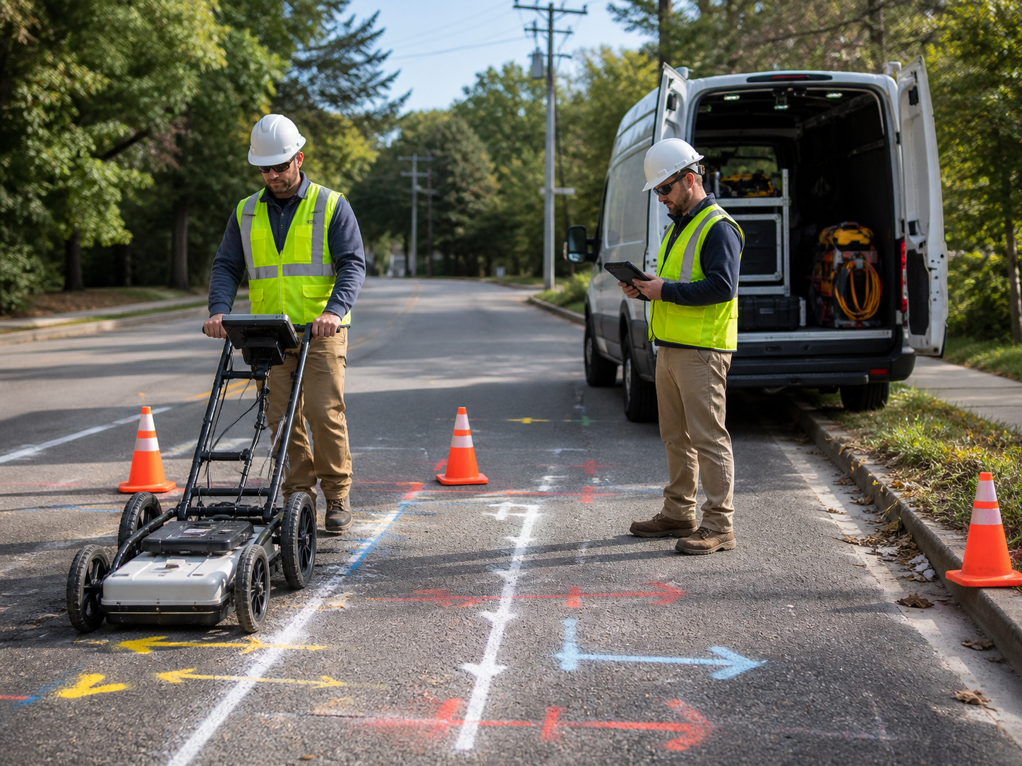
Utility Detection & Shallow Ground Scanning
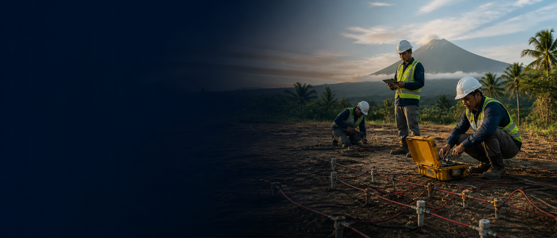
Know what's buried before anyone digs.
Underground Intelligence for Engineering Decisions
Groundwatch uses geophysical surveys to reveal underground conditions, identify hidden risks, and support better decisions before construction, drilling, excavation, or development.
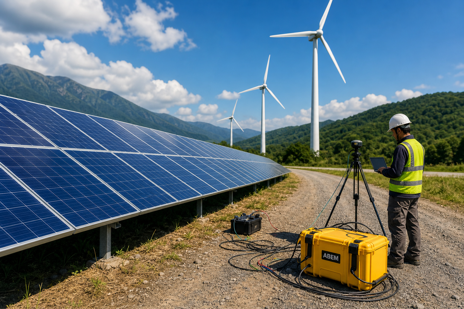
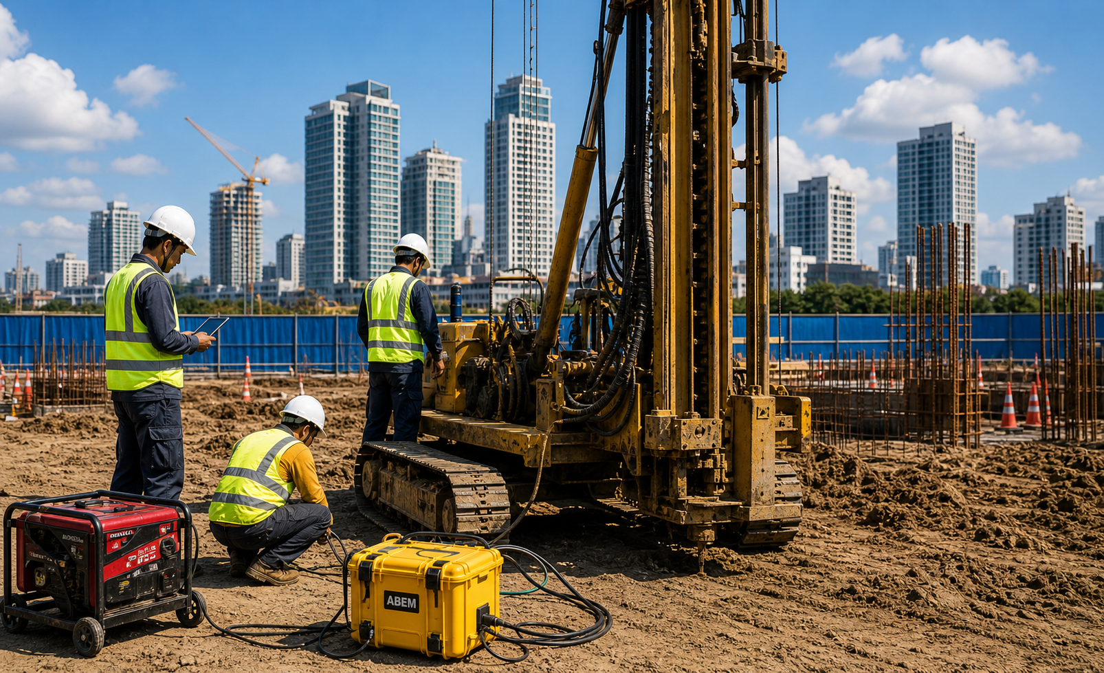
Non-invasive underground scanning for construction, energy, mining, water, infrastructure, and environmental projects.
The Ground Challenge
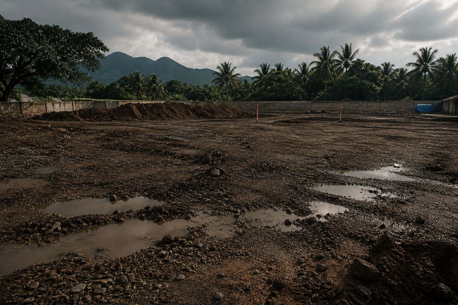
Before construction starts, everything may look ready — the plans, the budget, the schedule, and the team.
But the real problems are the ones you cannot see.
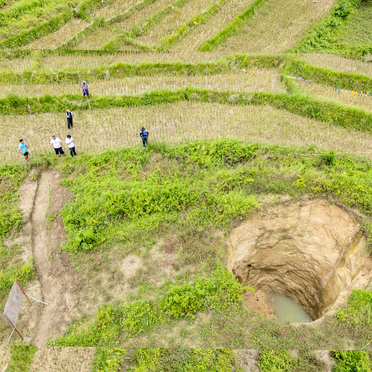
Soft ground. Underground water. Cavities. Buried utilities. Fractures. Weak zones. Variable depth to solid rock.
Groundwatch helps reveal these conditions before they become expensive problems.
What We Do
Geophysical Services
Different ground problems require different survey methods. Groundwatch selects the right approach based on your project objective, site conditions, target depth, and required output.
Know what's buried before anyone digs.
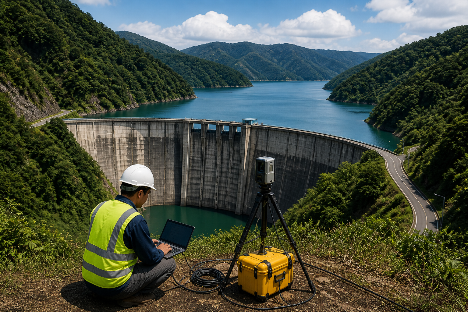
Find water, weak ground, and voids before they affect your project.
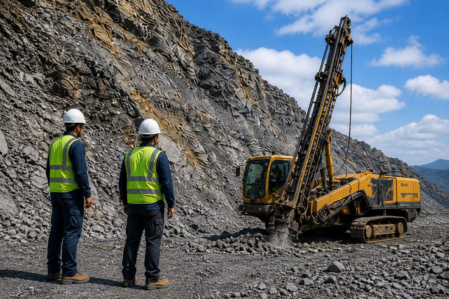
Find where solid rock starts and whether the ground is safe to build on.
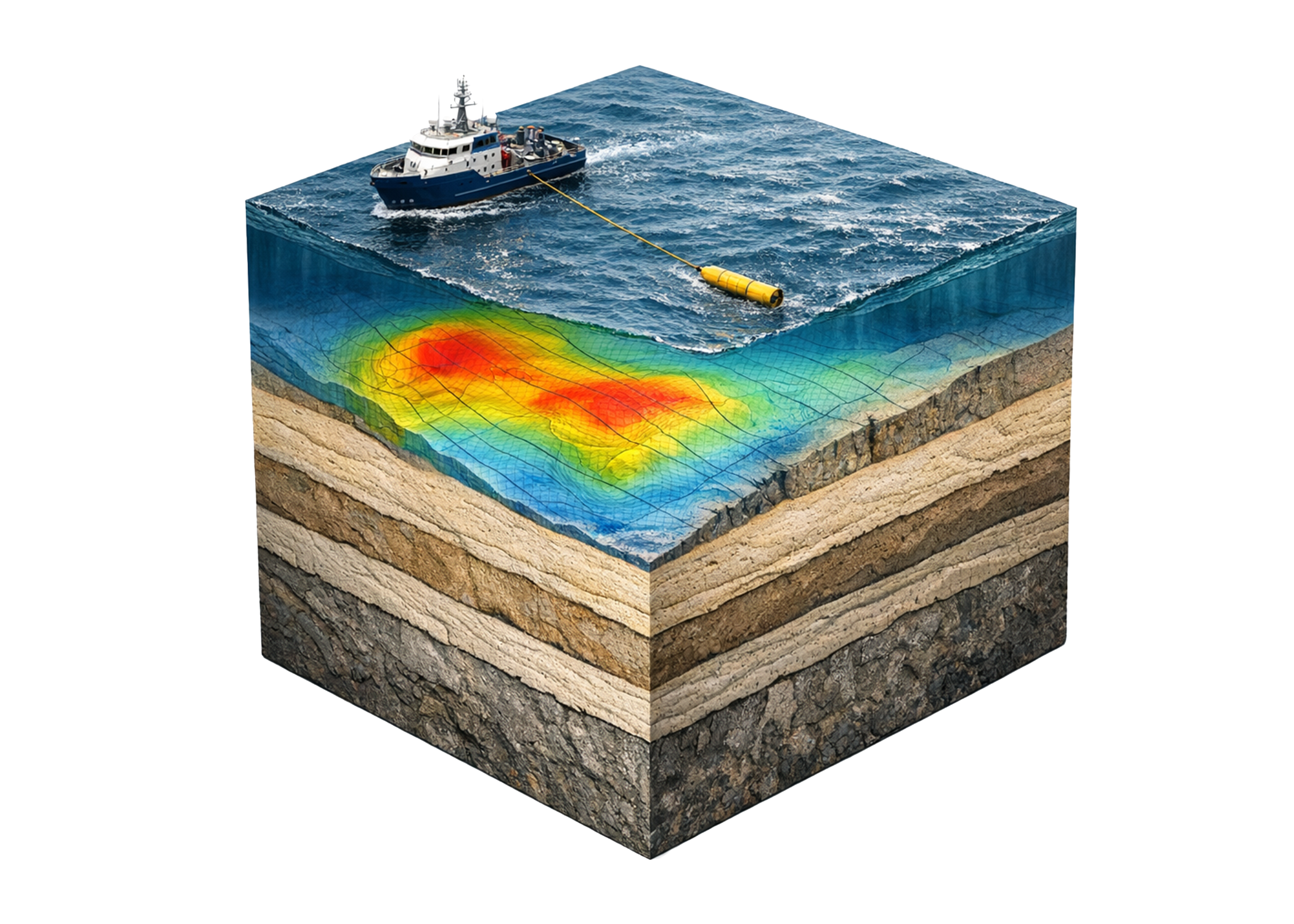
Find buried metal hazards and hidden geological patterns from the surface.
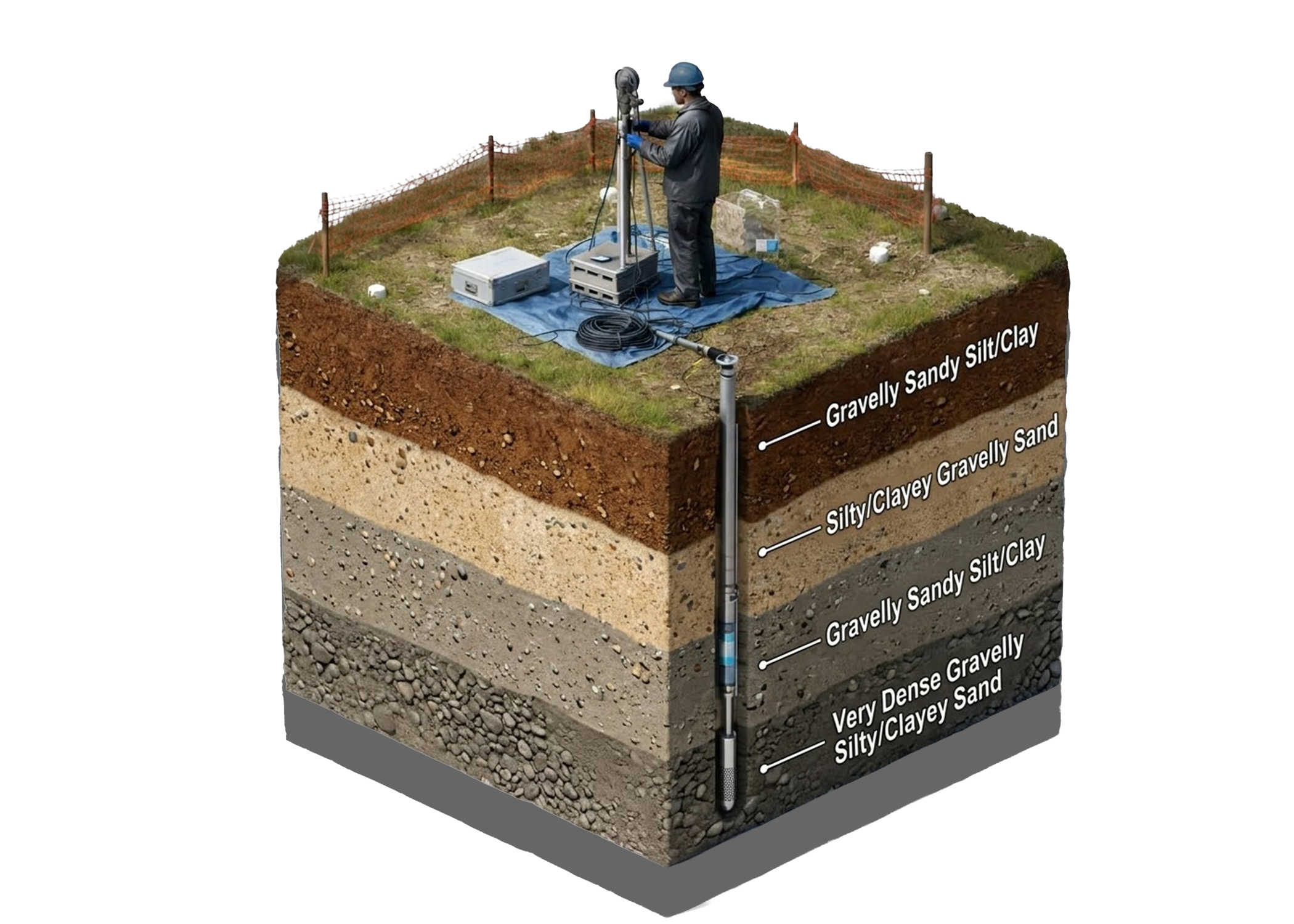
Confirm what the ground is made of — at the exact depths that matter.
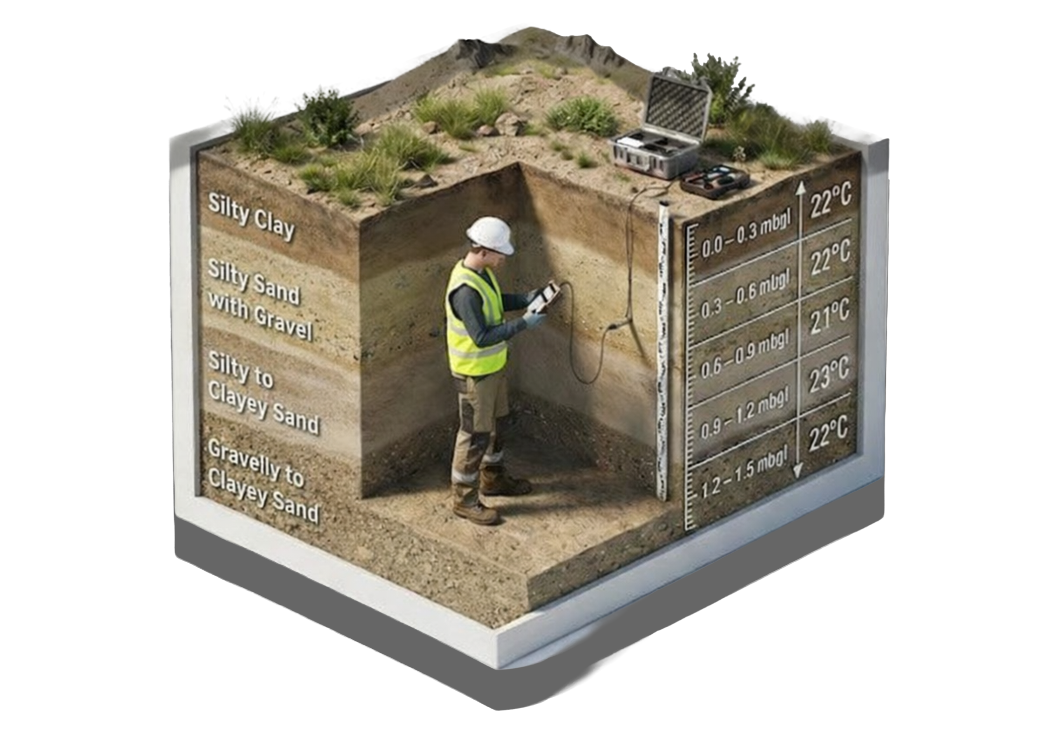
Measure exactly how the ground handles heat before specifying your cables.
How It Works
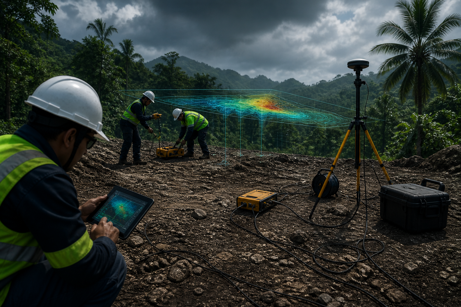
Every survey starts with the decision the client needs to make. We clarify the project objective, expected ground issue, target depth, access constraints, and required output.
Different underground problems require different geophysical responses. We select methods based on expected contrast, depth, resolution, and site conditions.
Survey lines, probe spacing, sensor spacing, radar scan grids, magnetic paths, and borehole positions are planned to match the engineering objective.
Field data is checked during acquisition to reduce errors caused by poor sensor contact, noise, access limitations, weather, positioning, or site interference.
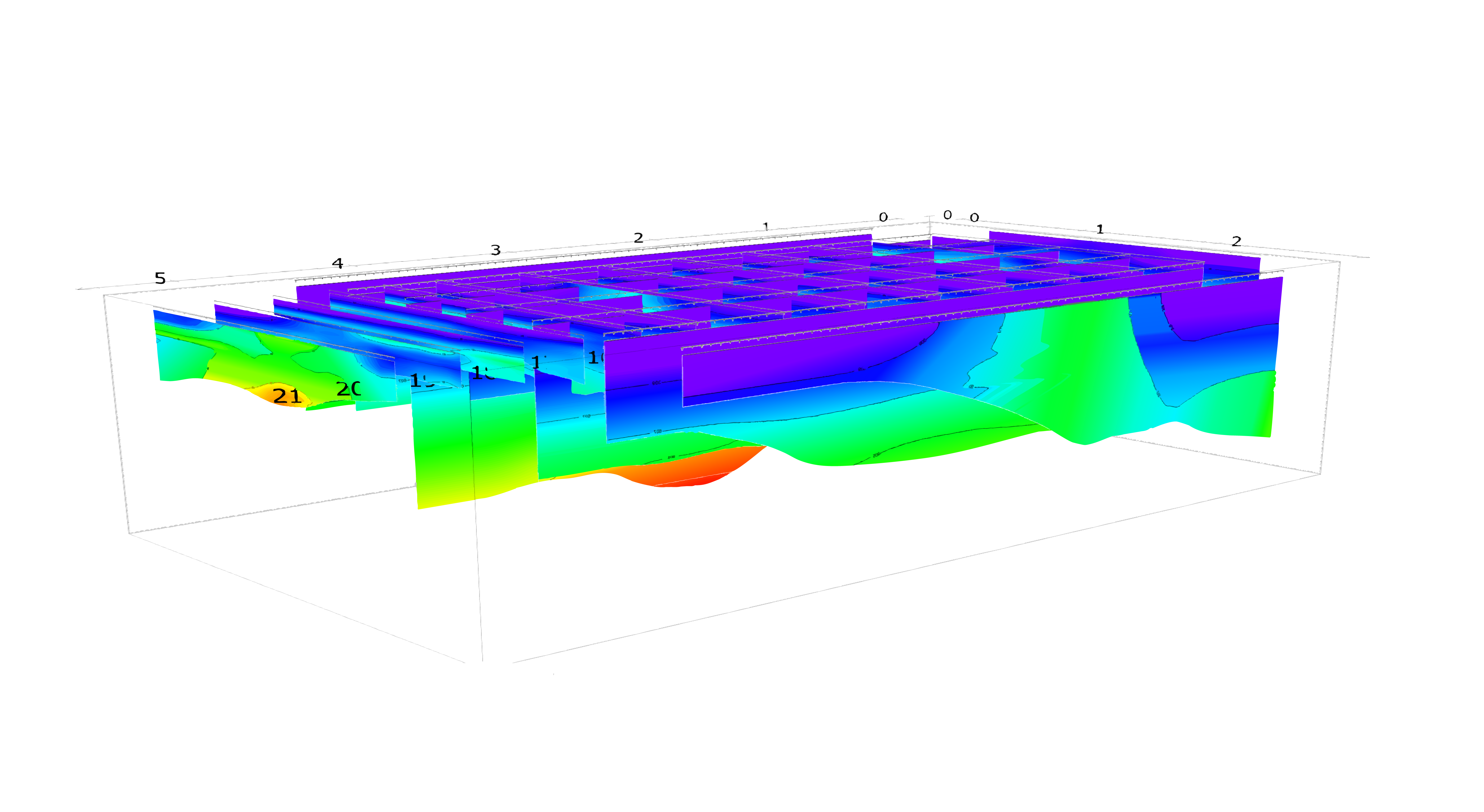
Measurements are processed, filtered, and converted into sections, profiles, maps, or 3D blocks depending on the method used.
The geophysical results are interpreted with geology, site observations, borehole data, engineering context, and known method limitations.
The final output is a clear technical report with maps, sections, models, interpretations, limitations, and practical recommendations for the next stage of work.
Define the Problem
Select the Right Method
Design the Survey Layout
Acquire & Quality-Check Data
Process & Model the Data
Interpret the Ground
Deliver Decision-Ready Outputs
Results
Groundwatch converts field data into visual, practical, and engineering-ready deliverables.
Underground conditions mapped and ready for engineering decisions.
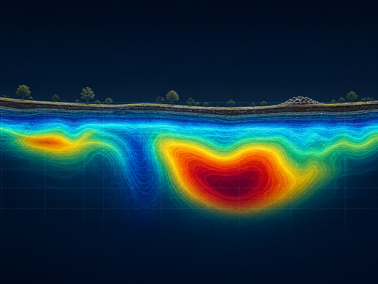
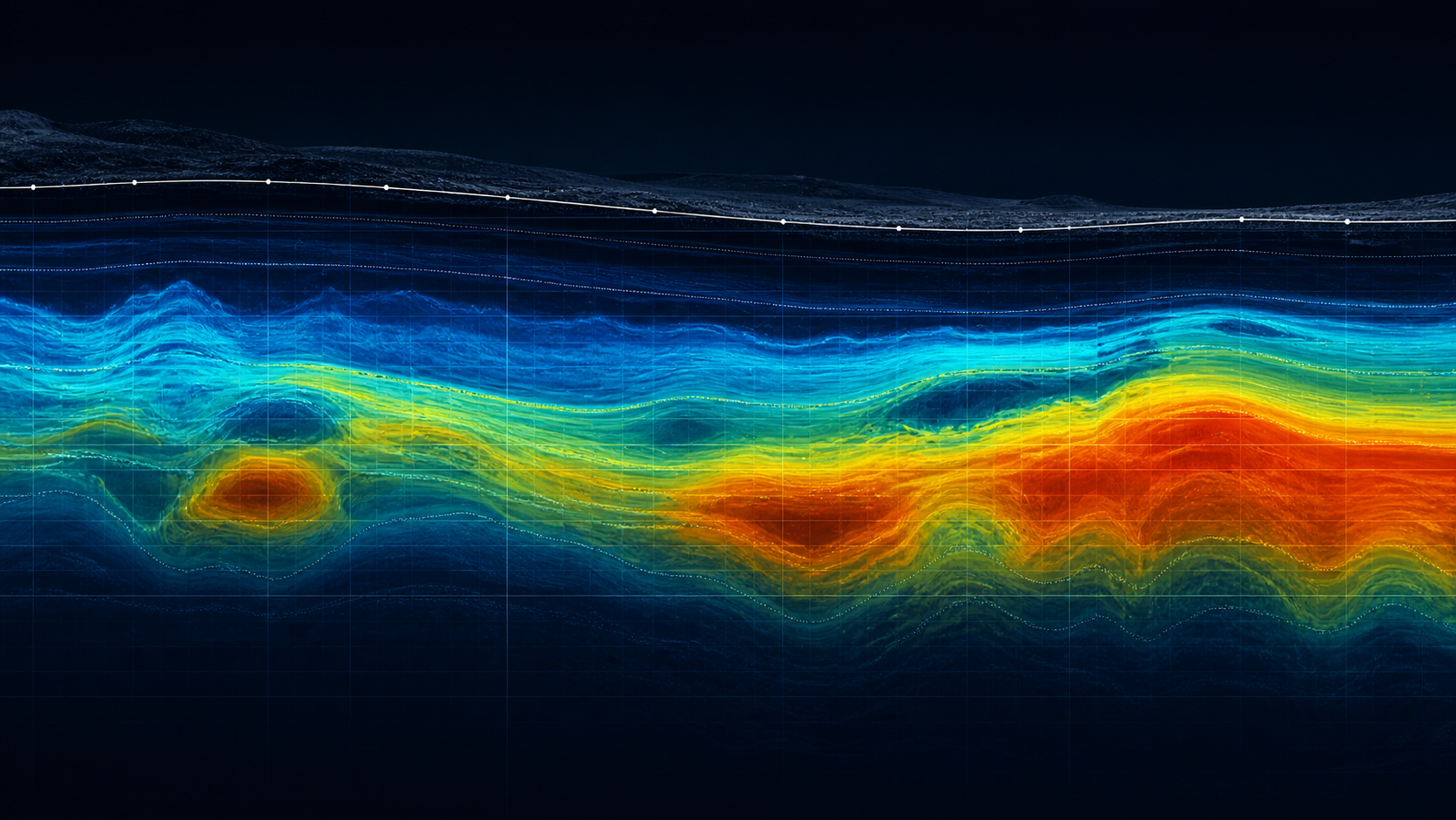
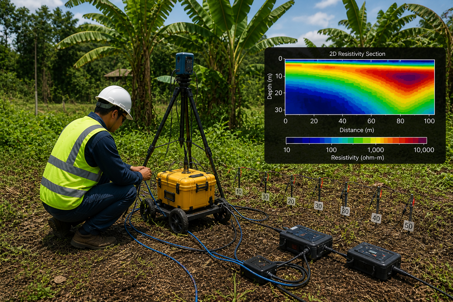
2D Cross-Section
Color-coded underground profile
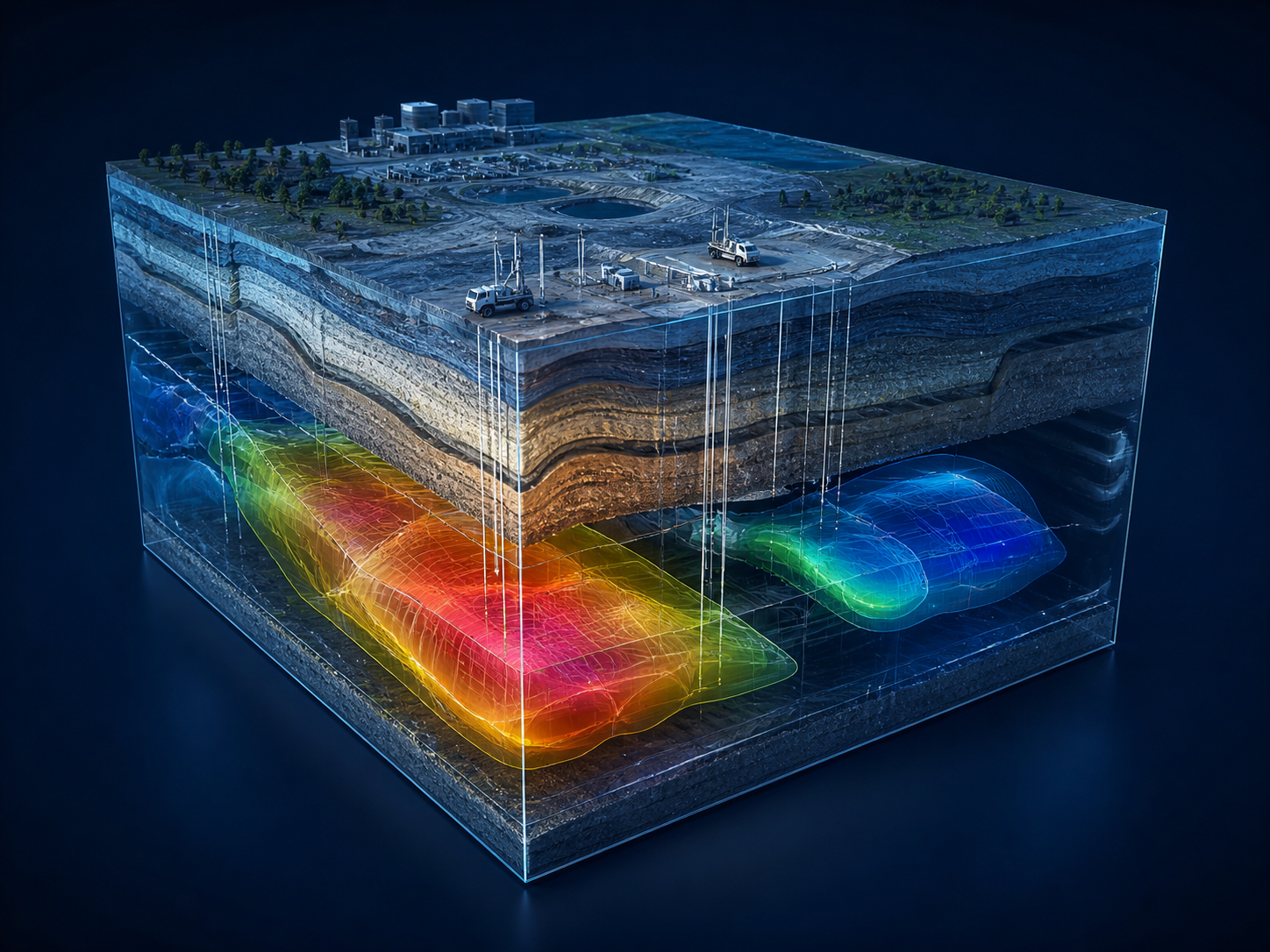
3D Underground Model
Block visualization of ground layers
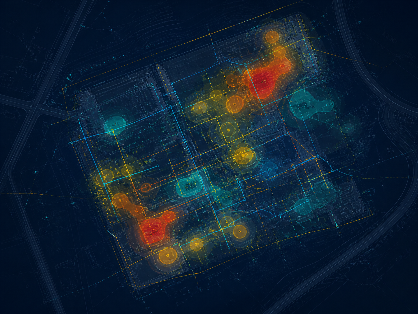
Underground Map
Plan view of targets and risk zones
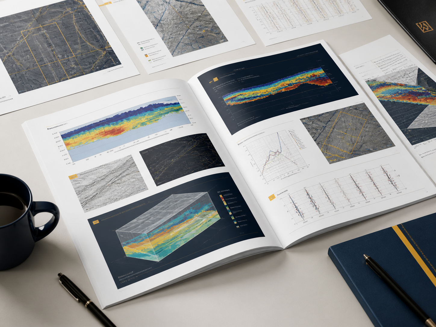
Technical Report
Interpretation, limits, and recommendations
Output types vary by survey method, site conditions, and project objective. Contact us to discuss specific deliverables for your project.
Risk Reduction
Geophysics helps identify possible underground concerns before they affect safety, cost, schedule, or design.
Without Geophysics
Surface looks ready. Real conditions remain unknown. False confidence leads to unexpected problems.
With Geophysics
Underground conditions are revealed. Unexpected readings are identified. Risk zones are mapped. Better decisions become possible.
Industries
Process
We define the client's objective, site condition, target depth, expected ground issue, and required output.
Case Studies
Problem
Large project area with possible variable ground conditions across the site footprint.
Methods
Electrical Resistivity Imaging, Seismic, Ground Penetrating Radar, Borehole Correlation
Result
Underground zones were interpreted to support planning and investigation priorities.
Problem
Client needed better understanding of shallow and intermediate ground conditions before design finalization.
Methods
Seismic Refraction, Surface Wave Analysis, Electrical Resistivity Imaging, Ground Penetrating Radar
Result
Velocity and resistivity sections helped identify possible changes in stiffness, saturation, and underground layering.
Problem
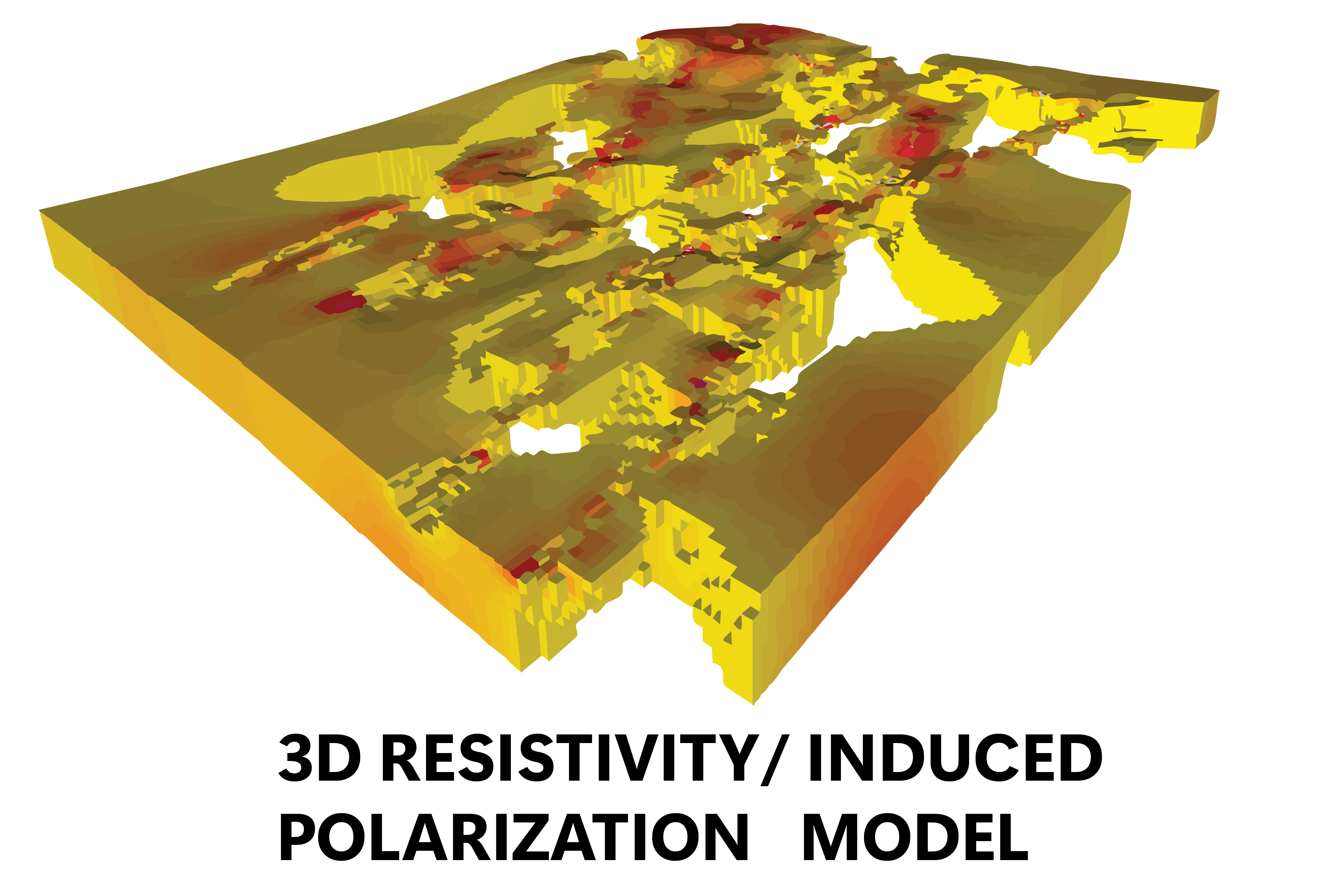
Exploration team needed geophysical targets for further drilling and geological interpretation.
Methods
Electrical Resistivity Imaging, Induced Polarization (IP), Magnetic Survey
Result
Unexpected reading zones were mapped and prioritized for follow-up investigation.
Problem
Concern for seepage, weak zones, and underground variability along embankment alignment.
Methods
Electrical Resistivity Imaging, Seismic, Surface Wave Analysis
Result
Interpreted sections helped identify zones requiring further engineering review.
Problem
Excavation area had possible buried utilities and shallow obstructions in a congested corridor.
Methods
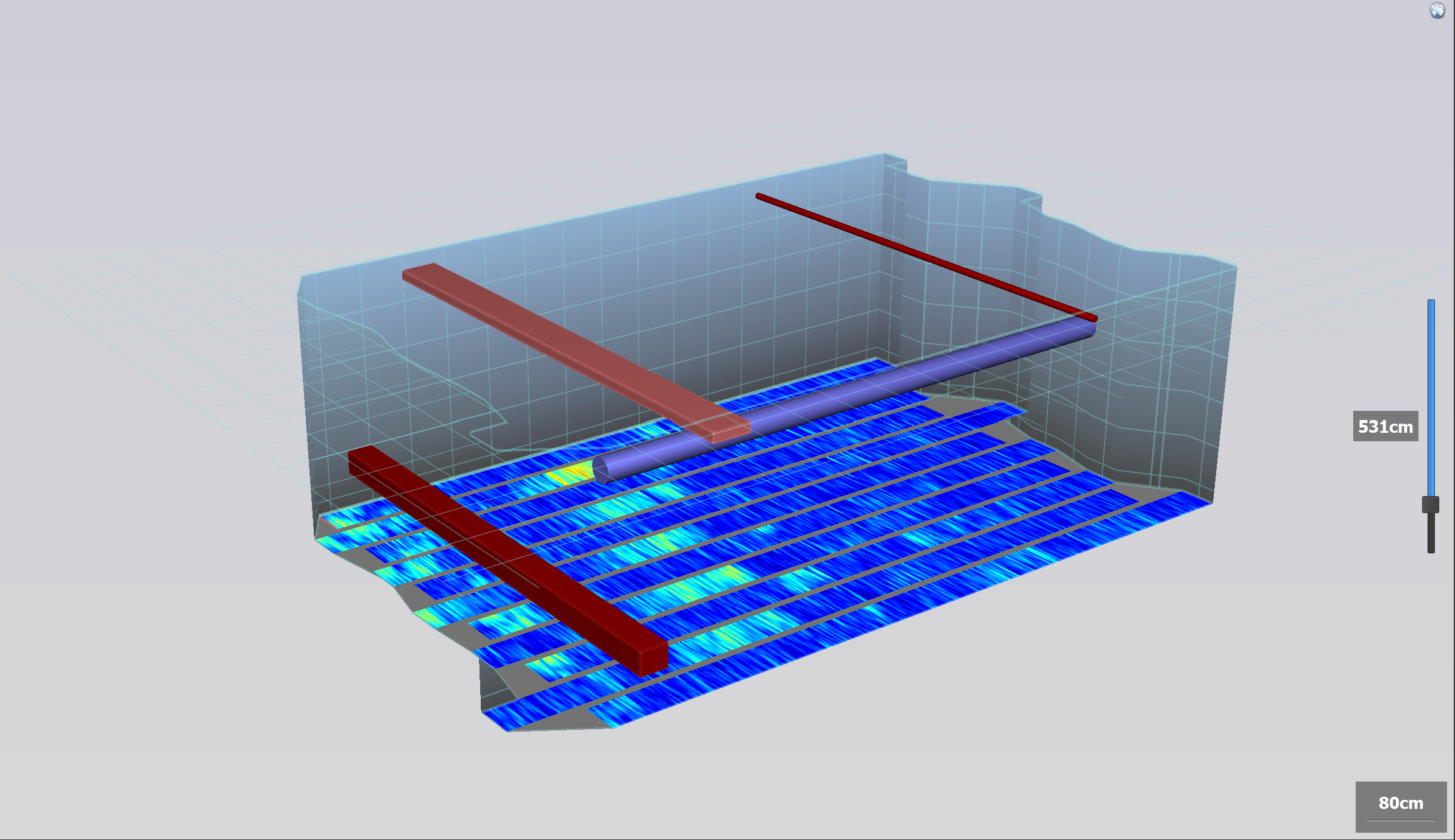
3D Ground Penetrating Radar, Utility Detection
Result
Mapped utility-like responses and unexpected shallow readings for safer excavation planning.
Problem
Client needed support for well siting and groundwater target identification in a rural area.
Methods
Electrical Resistivity Imaging, Hydrogeological Interpretation
Result
Possible water-bearing zones and structural controls were identified for follow-up validation.
Project details have been generalized. Real project images and results will be added when available.
About Groundwatch
Groundwatch Geophysical Surveying Services provides non-invasive underground investigation for engineering, construction, mining, renewable energy, water-resource, environmental, and infrastructure projects.
We combine survey design, field acquisition, data processing, interpretation, and engineering-oriented reporting to help clients understand ground conditions before major decisions are made.
Our work supports better borehole targeting, safer excavation planning, foundation assessment, groundwater exploration, utility detection, geological interpretation, and project risk reduction.
The focus is simple: make hidden ground conditions visible enough for better decisions.
6 Methods
Geophysical Survey Services
5 Domains
Physical Survey Principles
Pre-Design to Post-Construction
Project Stage Coverage
Philippines-Wide
Service Area
Get Started
Let Groundwatch help you understand the ground before it affects your budget, schedule, safety, or design.
Send us your site location, project objective, target depth, and available plans so we can recommend the right survey approach.